- Information on vegetation assemblage and habitat mapping were sourced from three main streams: 1.
Inventory data collected during field surveys, 2. Estimated proxies for vegetation structure and
phenology – vegetation indices, and 3. Estimates of spectral signatures for ground features from
time-series remote sensing imagery.
- To map the vegetation assemblages and habitats, the random forest classification algorithm was
implemented to delineate clusters of vegetation types, hitherto identified and grouped as clusters of
plant assemblages.
- Field referenced points and polygons for the vegetation assemblages were used to extract training
data from the stack of engineered spatial features (10 explanatory or predictor raster layers).
- In selecting a reliable classifier algorithm for the considered vegetation community or habitat
types, a Multi-Classifier System (MCS) of algorithms that comprise ensemble modelling, bagging, and
boosting: Random Forest ensemble decision tree (RF), Support Vector Machine (SVM), Regularized
discriminant analysis (RDA) model, Naïve Bayes classifier (NB), and the Gradient Boosting Model (GBM).
All model training was implemented using the “caret” library in R program.
- The RF classification algorithm had better performance (overall accuracy and kappa statistics) and
was applied to model the spatial location and distribution of the reference classes from field
inventory (clusters of vegetation assemblages and communities) and the available spatial (raster
image) predictors.
- Optimised the RF classifier algorithms using forward feature selection (Meyer et. al., 2018) and
spatial cross-validation procedure to reach the best model.
- A Leave-Location-Out Cross Validation (LLO-CV) was applied to address potential class selection bias
and overfitting, and a resampling control of 10-fold cross-validation with 5 iterations.
- The RF model training and cross validation was implemented within the “CAST” library (Meyer et al.,
2023) of the R statistical program.
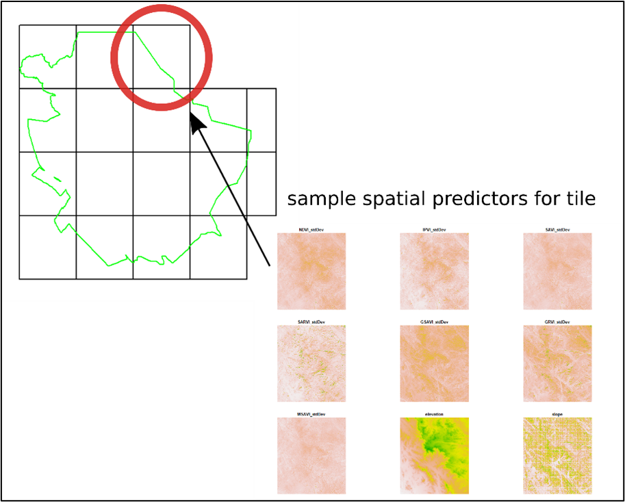
Arid Plant Communities Classifier Grid

Class Prediction Accuracy compared for classifier models
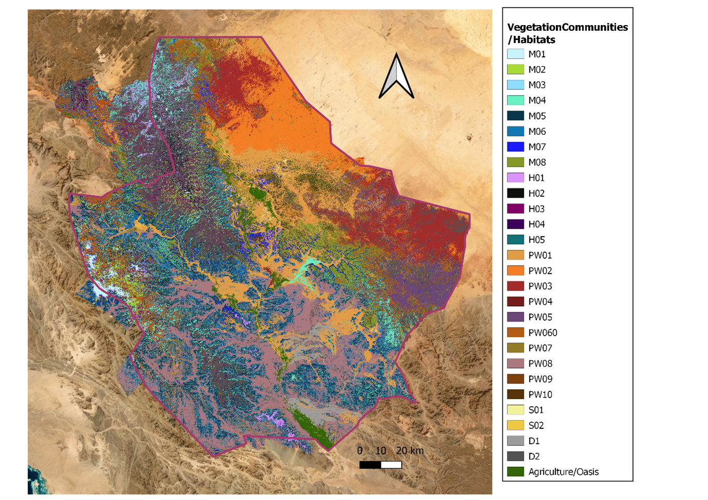
Vegetation communities and habitat map
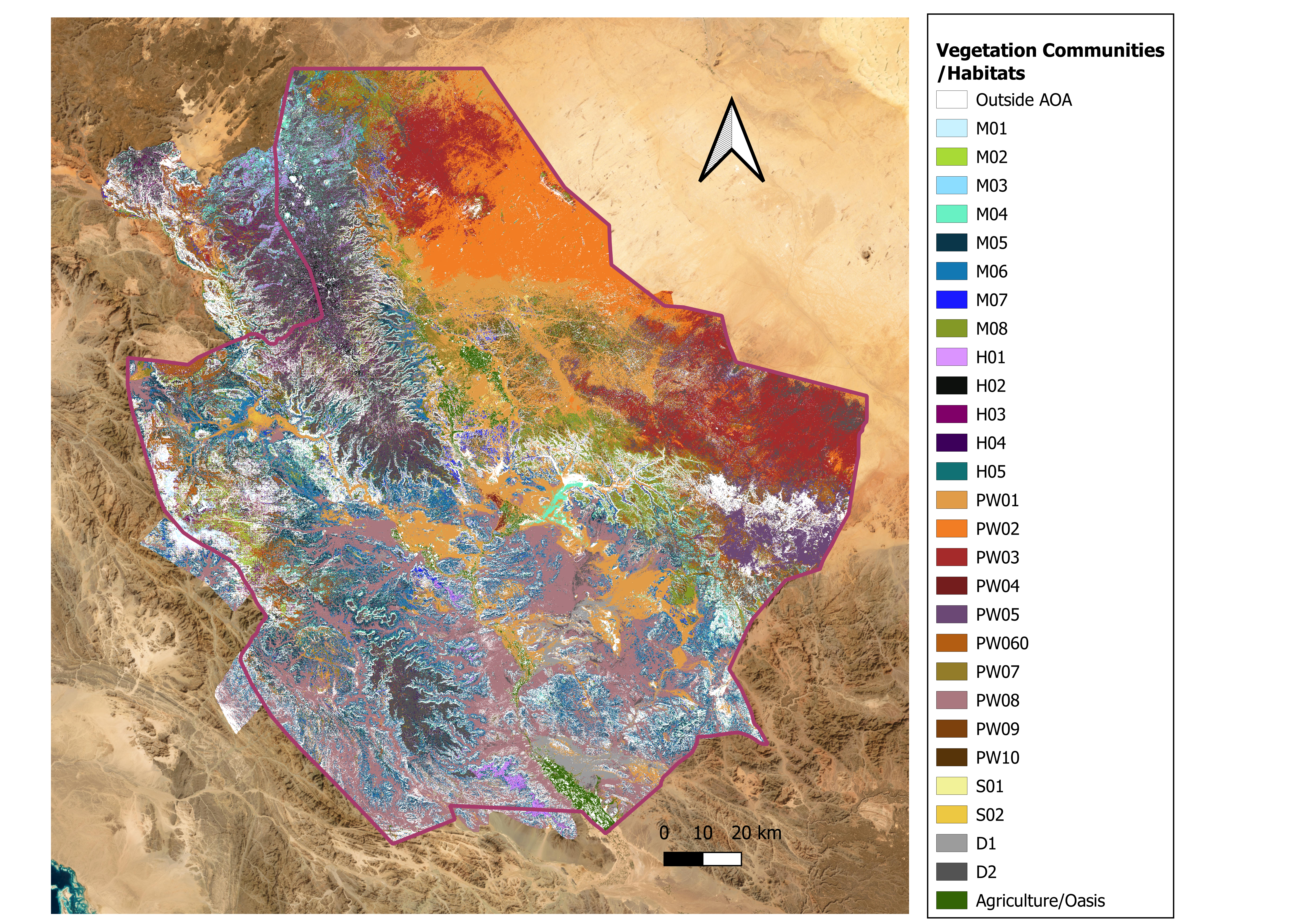
Vegetation communities and habitat map with consideration of Area of Applicability (AOA) of
classification model