Project 6: Predictor of Important Arid plants hotspots
- Create a Raster Grid for the Area of Interest (AOI) or study area.
- The raster grid is sub-divided in quared grids of desired size or analysis resolution. For instance, into 2km by 2km grid sizes.
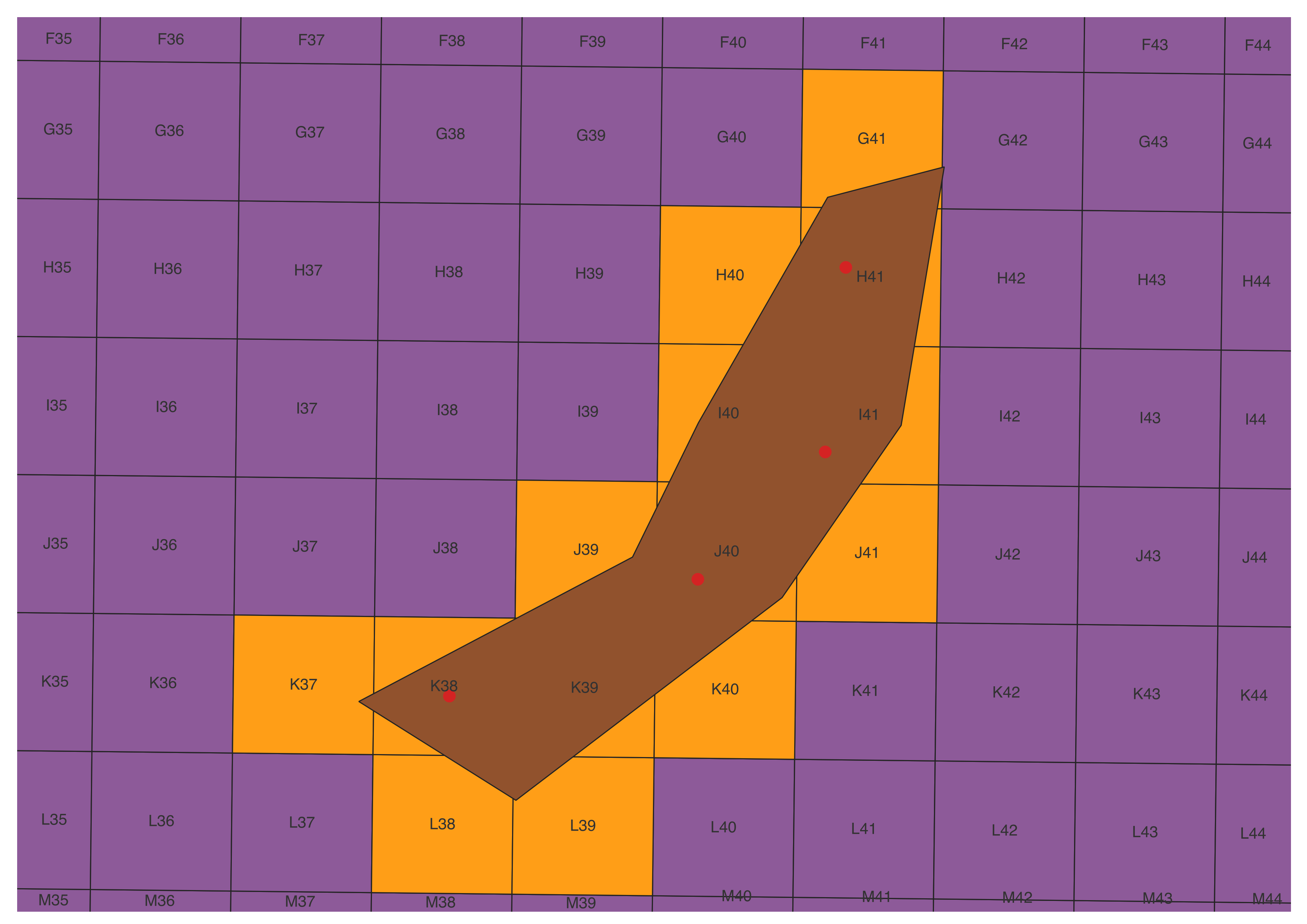
- Labelling each 2km square grid and creating unique Cell IDs (for each grid). These constituted the references to track and concatenate the species distribution within and across grids.
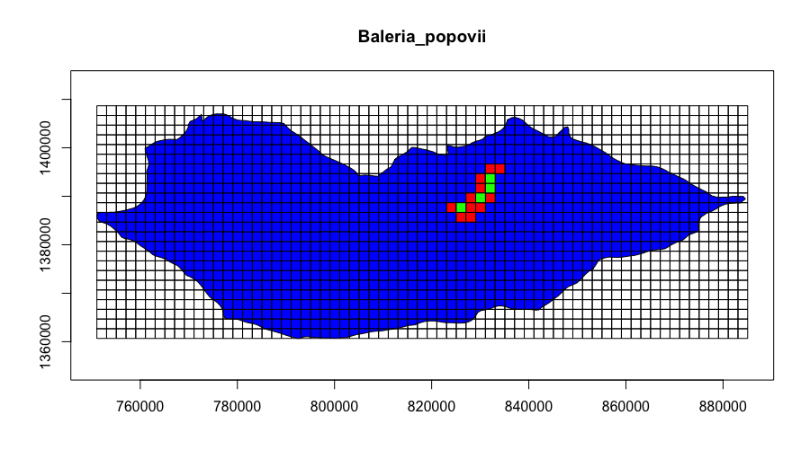
- Use information on actual species distribution (point coordinates of observed presence) to cross-correlate data on inferred species distribution obtained from literature and experts' knowledge.
- Apply threshold criteria for area of inferred distribution polygons intersecting the grids of observed presence to classify grids for the target species distribution.
- Develop species distribution hotspot grids following IUCN threshold criteria i.e. Endemic species, Threatened speacies, etc.
Important Plant Area (IPA) Study Area Grid
Species Distribution Analysis Grid
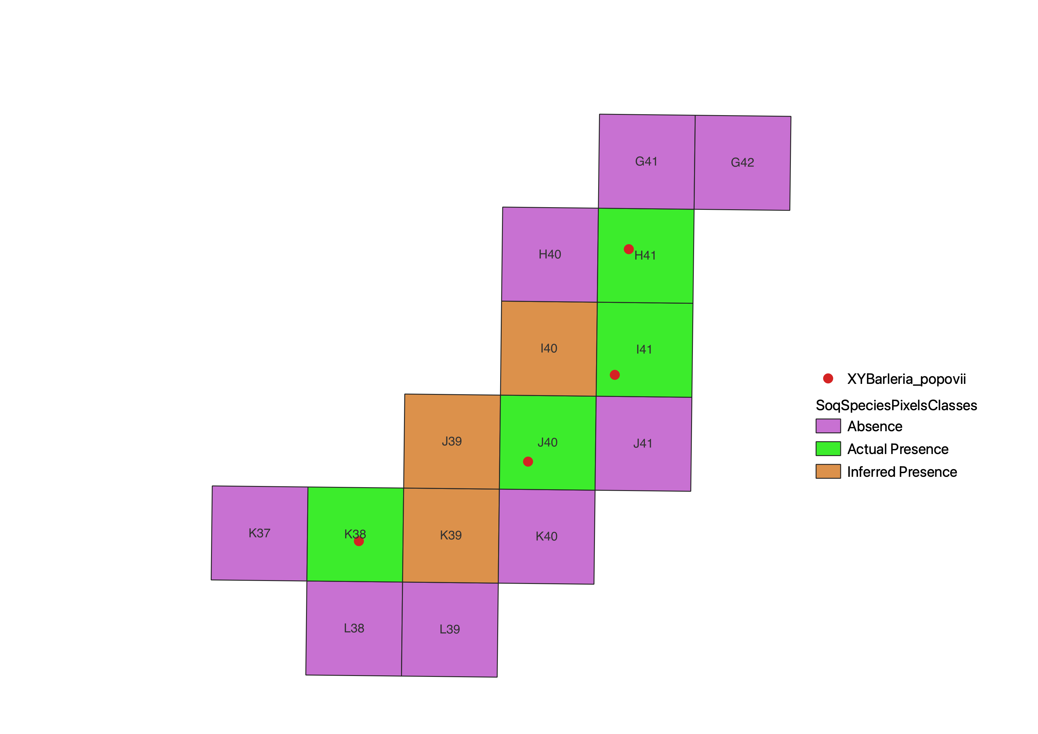
Target Species Grid Classification
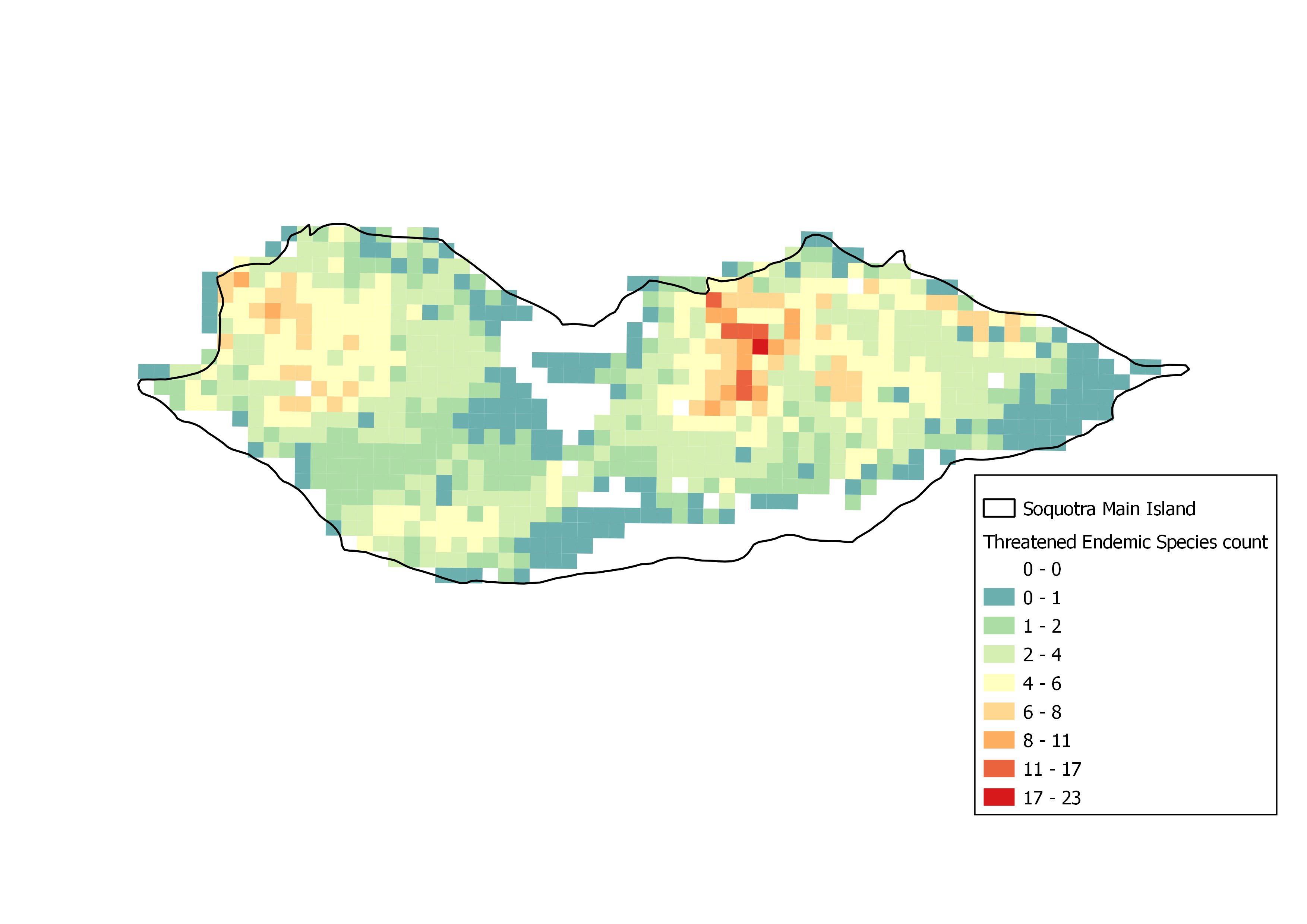
Distribution Hotspot Grid for Threatened Endemic Species