Project 1: Cocoa Agroforestry Land Use Classifier
- Developed a classifier procedure for discriminating perennial cocoa agroforestry land use from forests and other land uses with similar vegetation and canopy structures.
- Compared a multi-spectral optical image from RapidEye, acquired in the dry season, and multi-seasonal C-band SAR of Sentinel 1.
- Hand engineered Grey Level Co-occurrence Matrix (GLCM) texture features (images) from Sentinel-1 Image time series covering six dry and four wet seasons from 2015 to 2017.
- Optimised Random Forest Ensemble classifier models using different input feature combinations; multi-spectral reflectance, vegetation indices, co-(VV) and cross-(VH) polarised SAR intensity and GLCM texture measures.
- Evaluated accuracy metrics and uncertainty Shannon entropy - information loss in classification.
- Built a classifier and uncertainty measures that provide reliable validation of class discrimination at different spatial resolution.
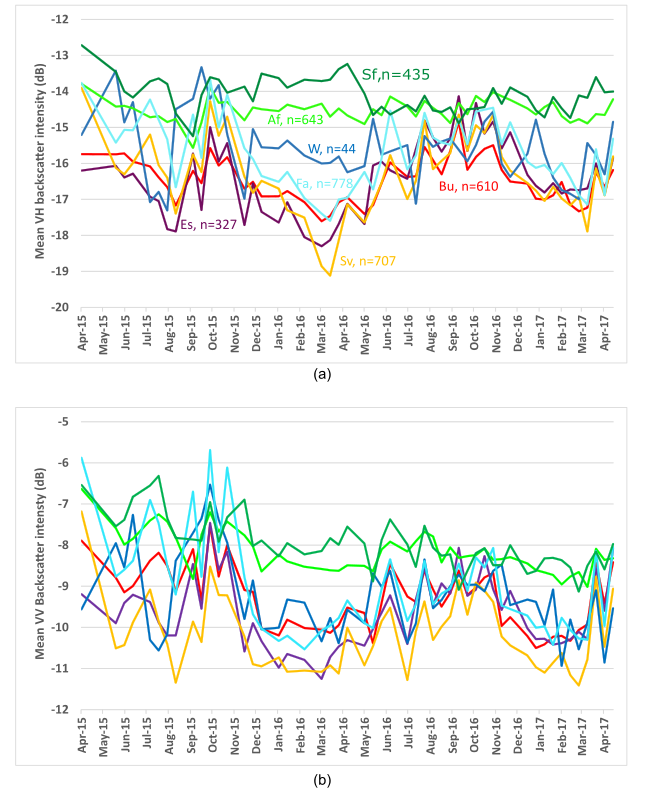
SAR Backscatter Time-series over different land uses
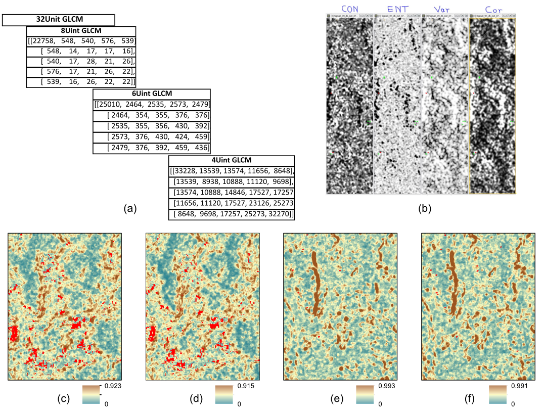
Sentinel-1 SAR GLCM Texture-Based Discrimination of Cocoa Agroforestry land use
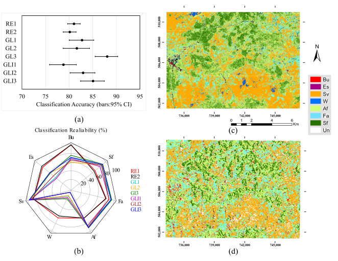
Land use classification compared for Sentinel-1 SAR and Rapid-Eye
- Link to GitHub Repository
- Link to Reference Scientific Publication 1 - 2018
- Link to Reference Scientific Publication 2 - 2019